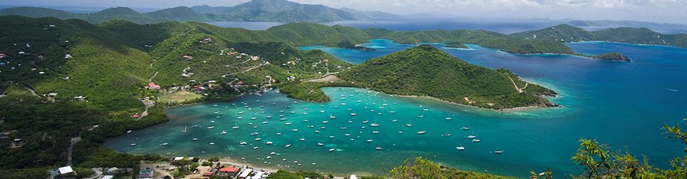
On August 27, 2015 the island of St John experienced the wind and wave conditions of Tropical Storm Erika. Although a fairly minor storm (top winds of around 50 mph), the impacts on Coral Bay harbor and the boats in it were quite significant.
Coral Bay Harbor Ocean Exposure
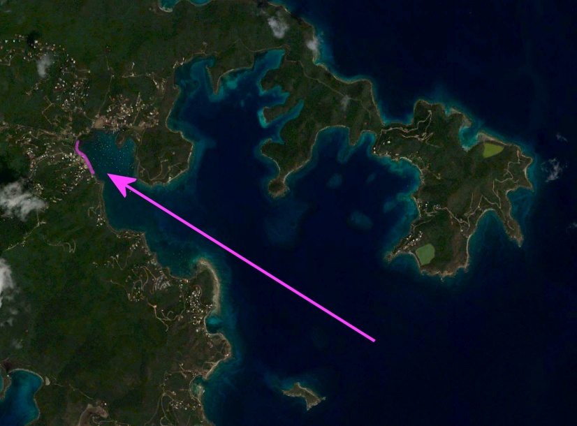
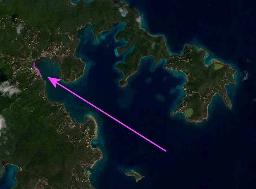
In the aerial photograph below, the portion of Coral Bay that is open to the ocean is clearly identifiable. The eastern shore of Coral Bay has a direct line to the open ocean (known as an open or unlimited fetch).
This exposure is also clearly seen from the hillsides above Coral Bay, where the direct exposure to the open sea is clearly evident:
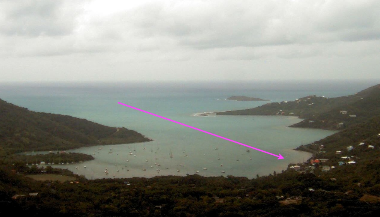
As a consequence of this open exposure, the eastern shore of Coral Bay experiences the greatest wind and wave impacts in Coral Bay. During TS Erika five foot waves were reported in this vicinity (and that was with winds probably no greater than 50 mph).
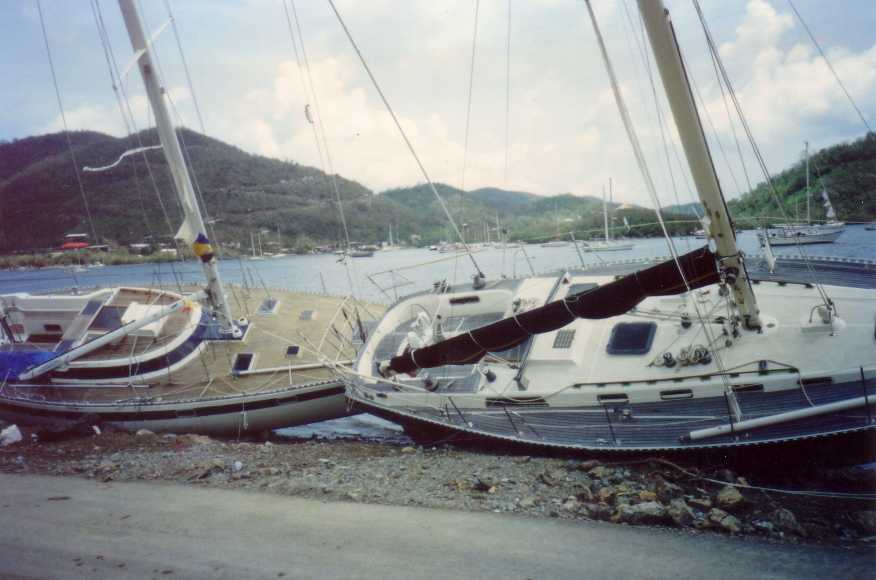
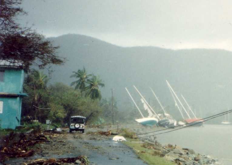
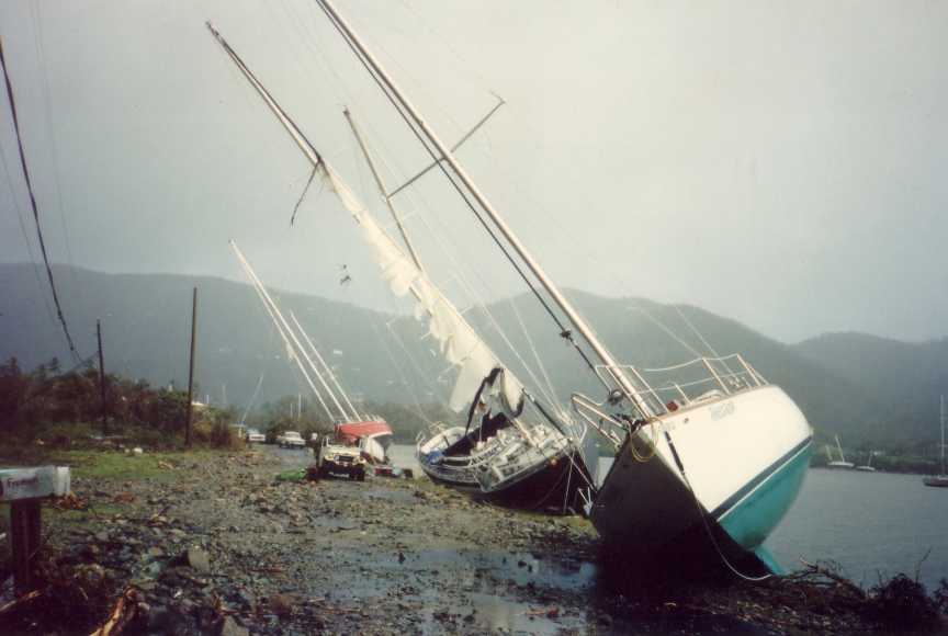
This is also the location where any boat that has lost its mooring will come to shore. It has happened in EVERY major storm to impact Coral Bay. Here are some images of this shoreline after Hurricane Hugo (1989):
Tropical Storm Erika
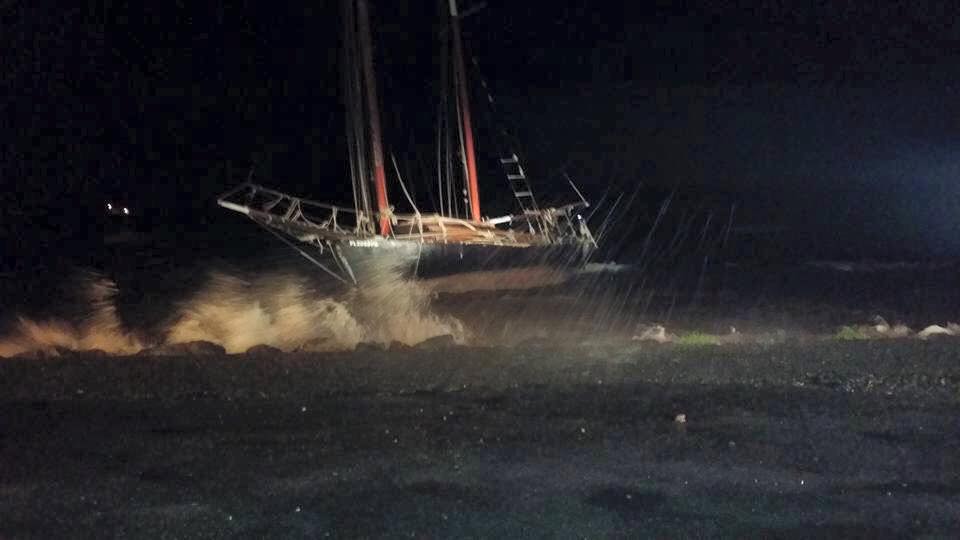
On the evening of August 27, 2015, even before the most intense winds of TS Erika had arrived, the sailboat “African Queen” broke its mooring chain and was pushed onto the rocks directly in front of the “Voyages” building in Coral Bay. This is the precise location where the main pier of the Summer’s End Group marina is proposed to be located. At night, the African Queen can be seen being battered by wind and waves:
And by daybreak, another boat had joined African Queen on the shoreline. The hull of “Jaws” – which had been resting on the bottom after sinking over a year ago, was pushed by wave and wind action up to the same shoreline:
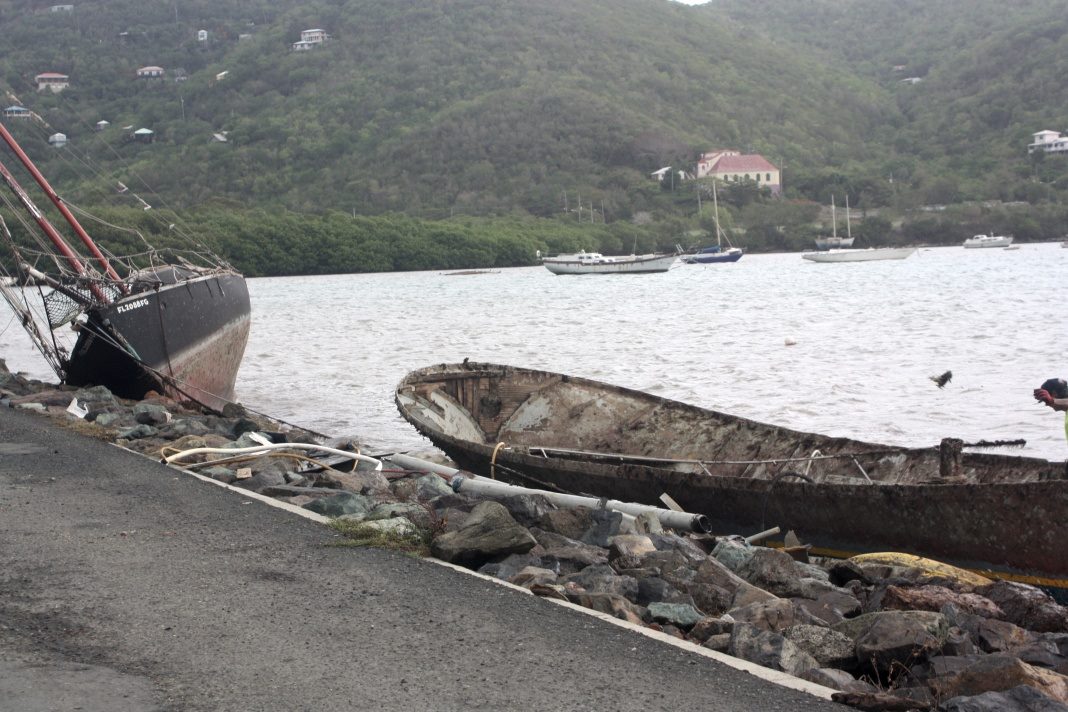
This is NO LOCATION for a safe marina. Any object that breaks loose in a storm will be pushed directly to this part of the shoreline. When asked at the Coastal Zone Management public hearing whether the Summer’s End Group marina could withstand a hurricane, their marina expert said that the marina could withstand a hurricane, but if a boat were to crash into it then all bets were off.
At the CZM public hearing of August 2014, the chair of the CZM Committee asked the marina developers “what is your assurance about the design to withstand an average hurricane?”
Mr. Jeff Boyd, the SEG marina consultant, replied “It’s impossible to build a marina that is hurricane perfect. It just can’t be done. The bottom line is the marina would most likely stand, the piles will still be there, but if somebody’s barge gets loose and comes charging at you at 20 knots, it’s going to take out something and there is not a whole lot anybody can do to stop that. So what we do is, we build a facility that withstand Mother Nature on its own. We can’t build anything that will withstand humans, and if somebody leaves a barge unattended or a yacht unattended, not anchored, or whatever the case may be, we always run that risk.”
That is EXACTLY what happens at this location during every major storm: boats break loose from their anchor lines elsewhere in the harbor and come crashing to the shore in this precise location. If a marina were located there it could be a total wreck. The photograph below is a marina after significant storm impacts – imagine the environmental damage from fuel leaks, toxic pollutants, and physical debris:
![hurricane-overturned-damaged-sailboats-debris_noaa_980[2]](https://savecoralbay.com/wp-content/uploads/hurricane-overturned-damaged-sailboats-debris_noaa_9802.jpg)
Conclusion
The western shore of Coral Bay harbor is exposed to the open ocean. As a consequence it experiences extreme wave and wind energy impacts during any major storm. Boats that lose their anchor lines anywhere in Coral Bay impact the shoreline at this location. It is NOT the correct location for a marina.