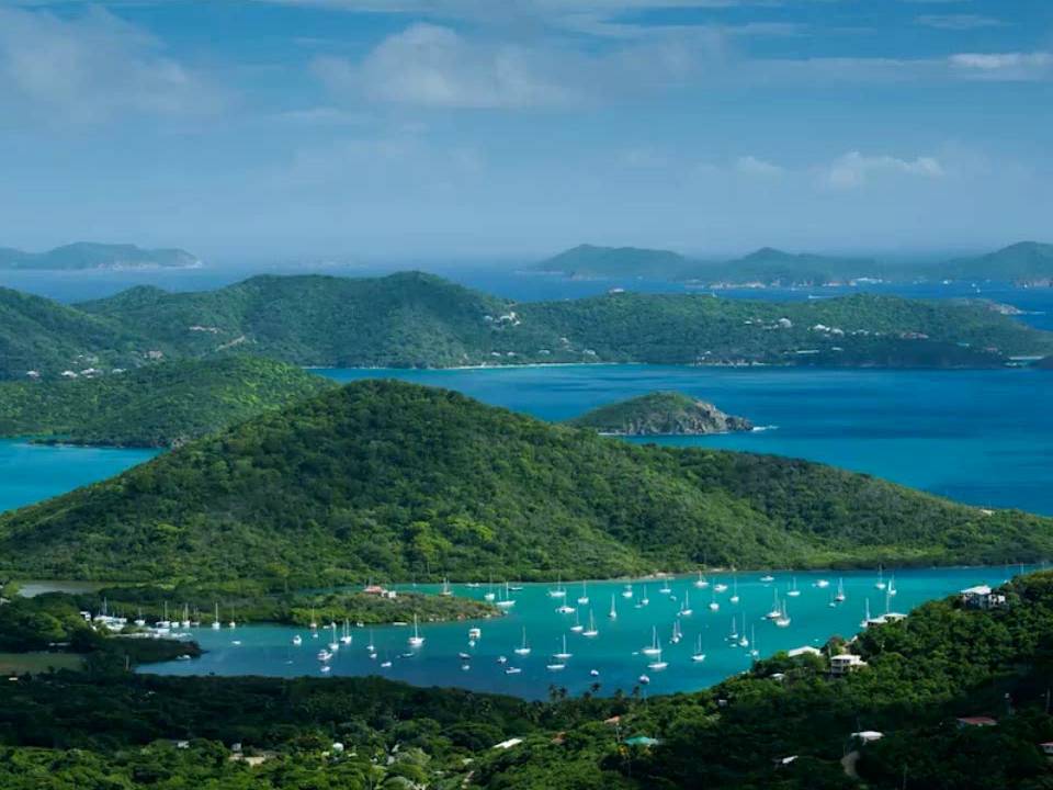
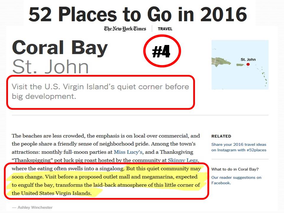
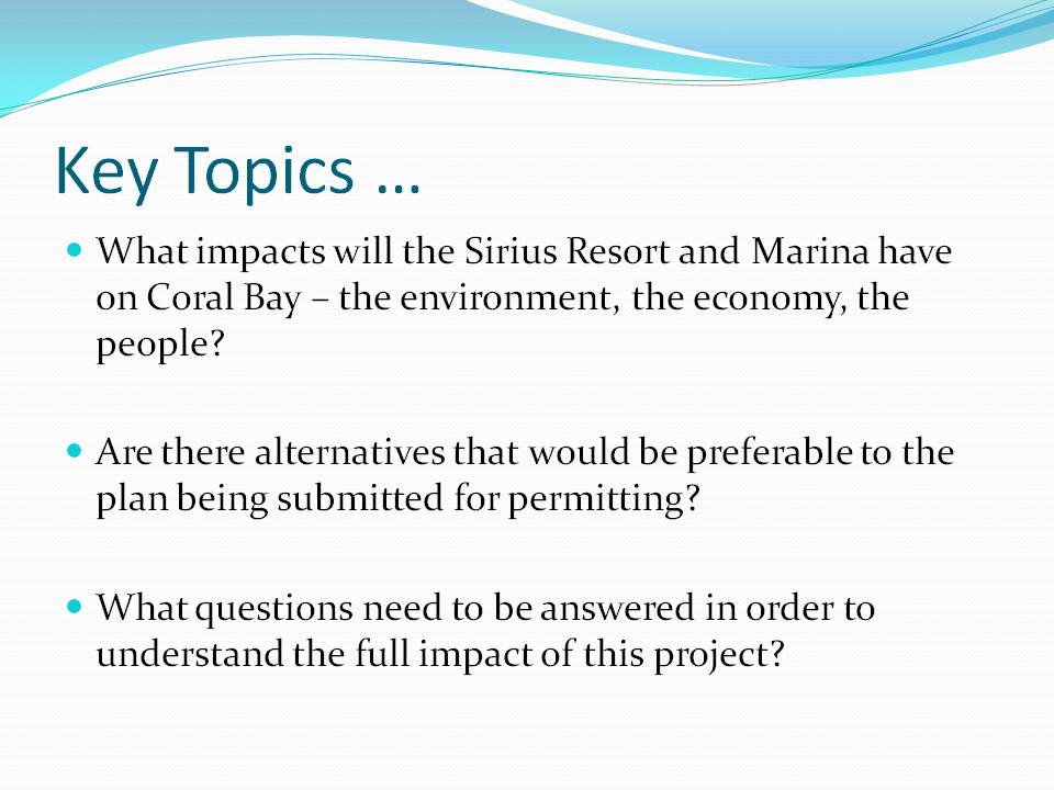
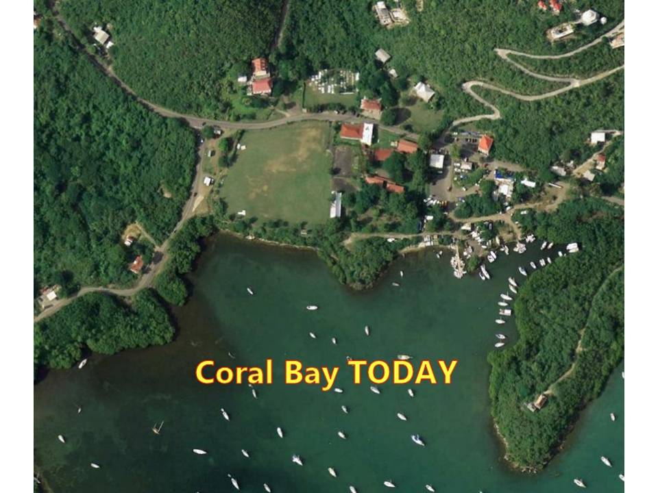
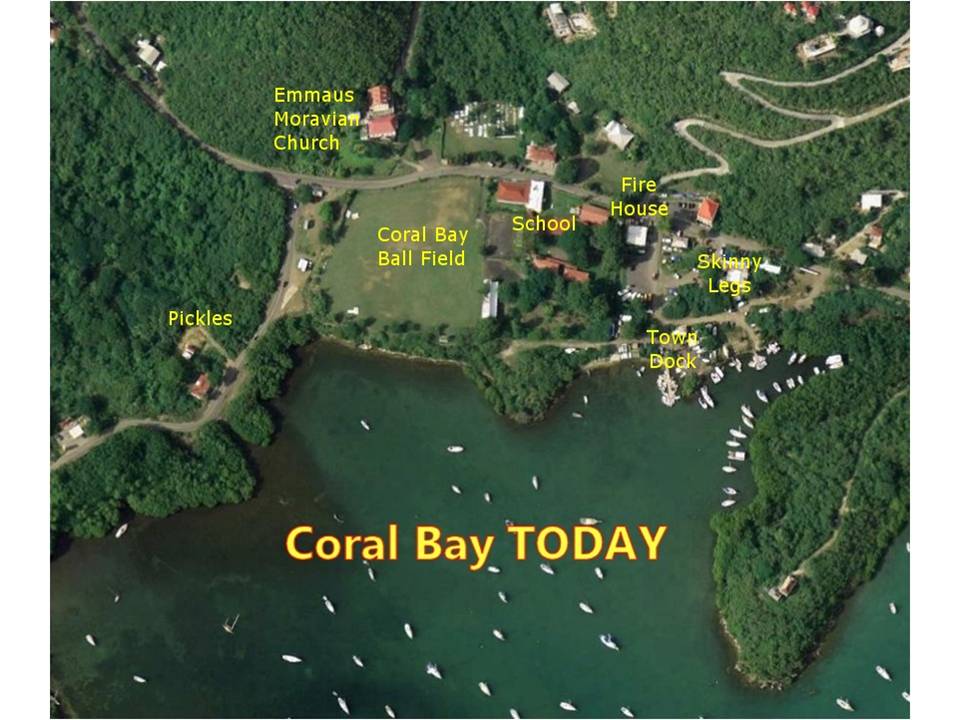
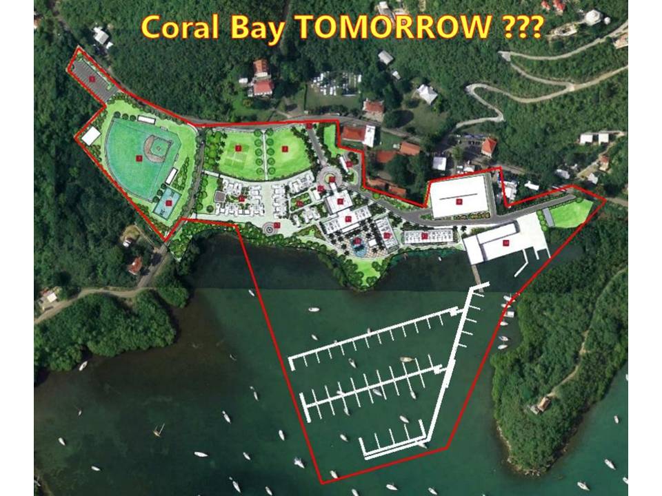
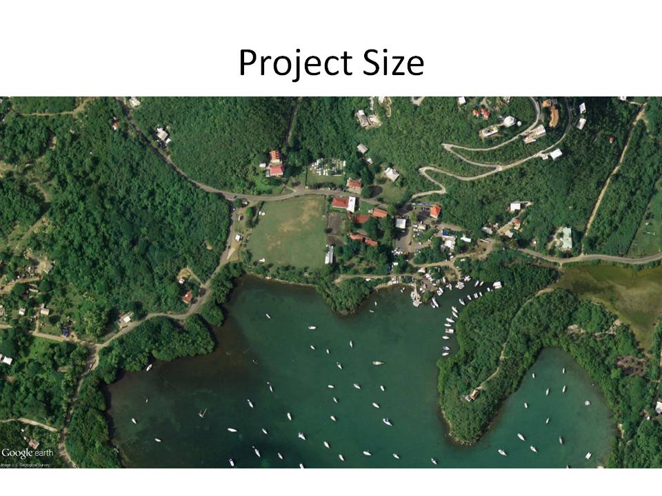
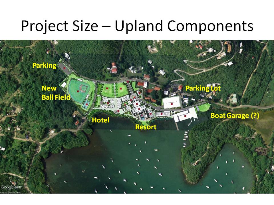
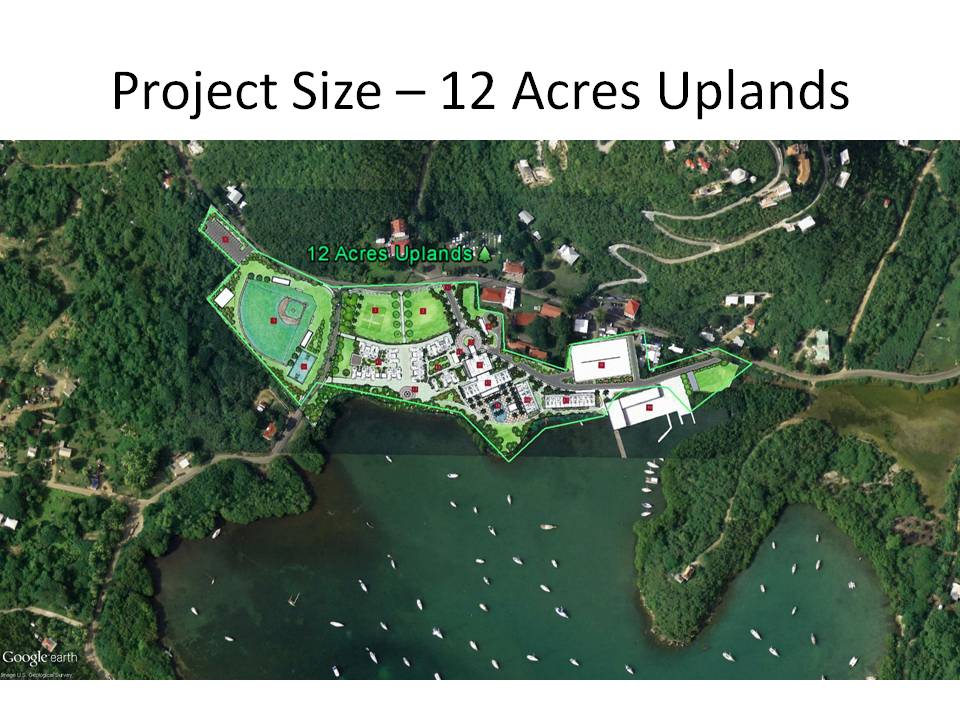
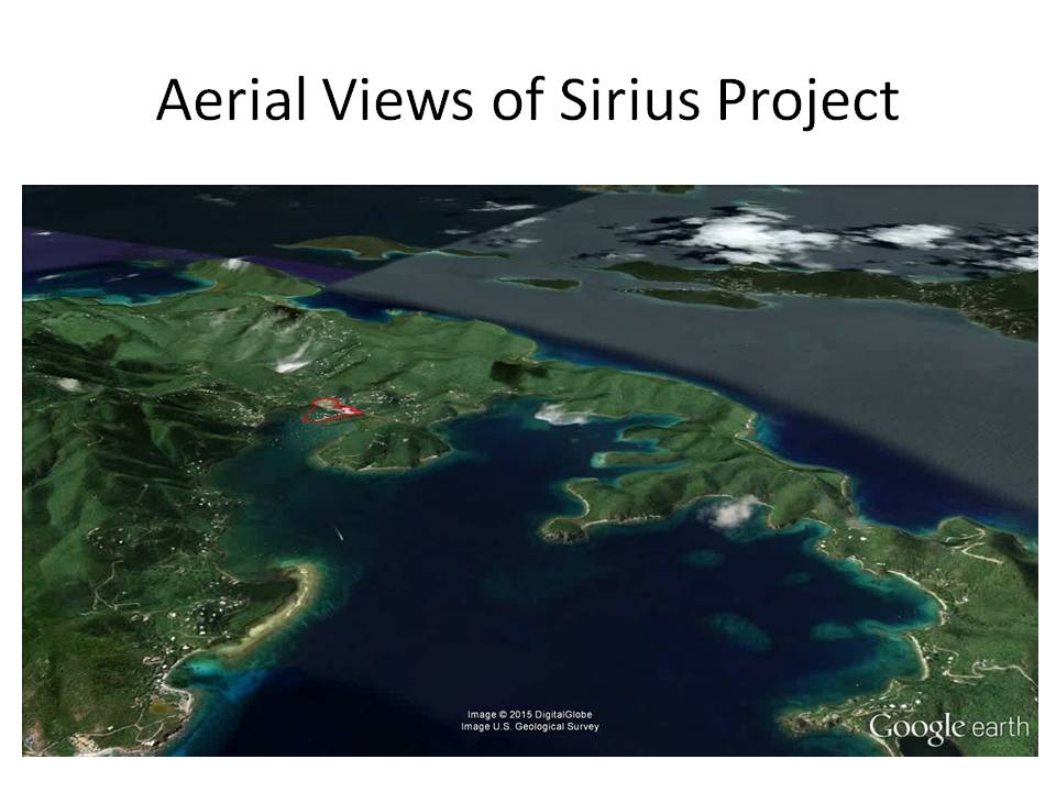
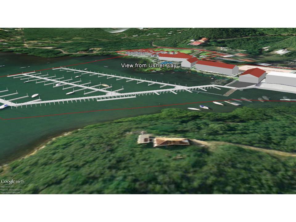
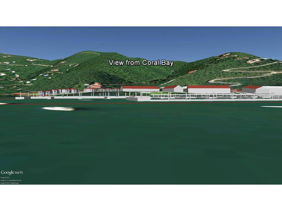
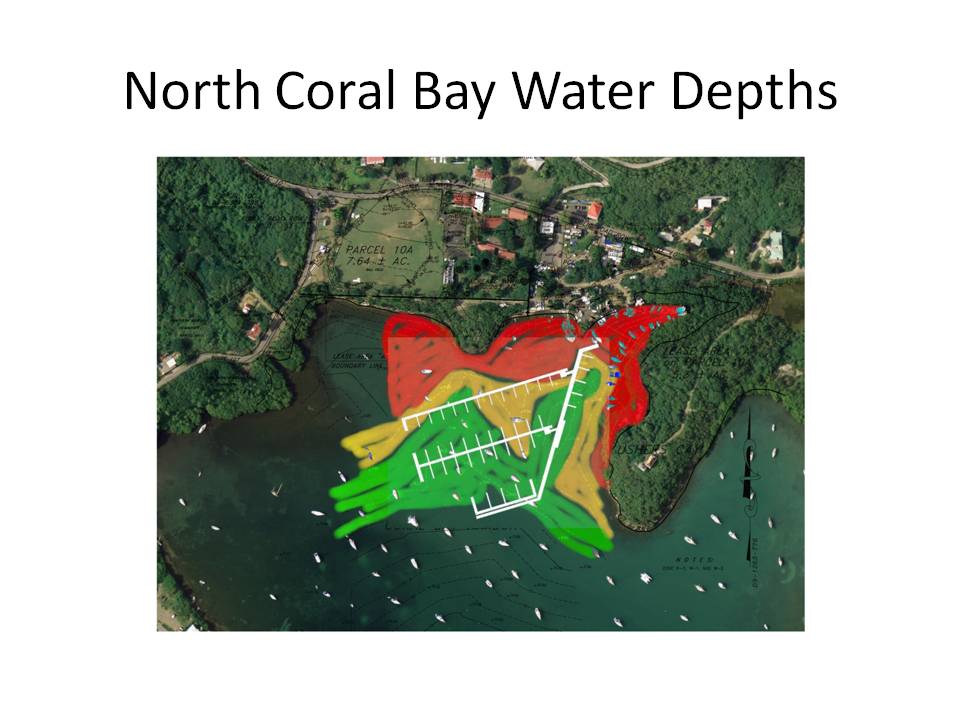
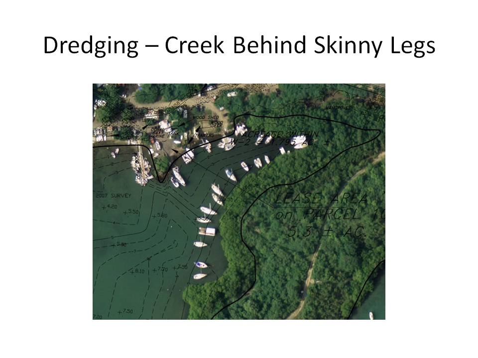
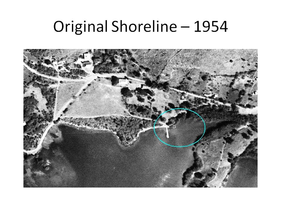
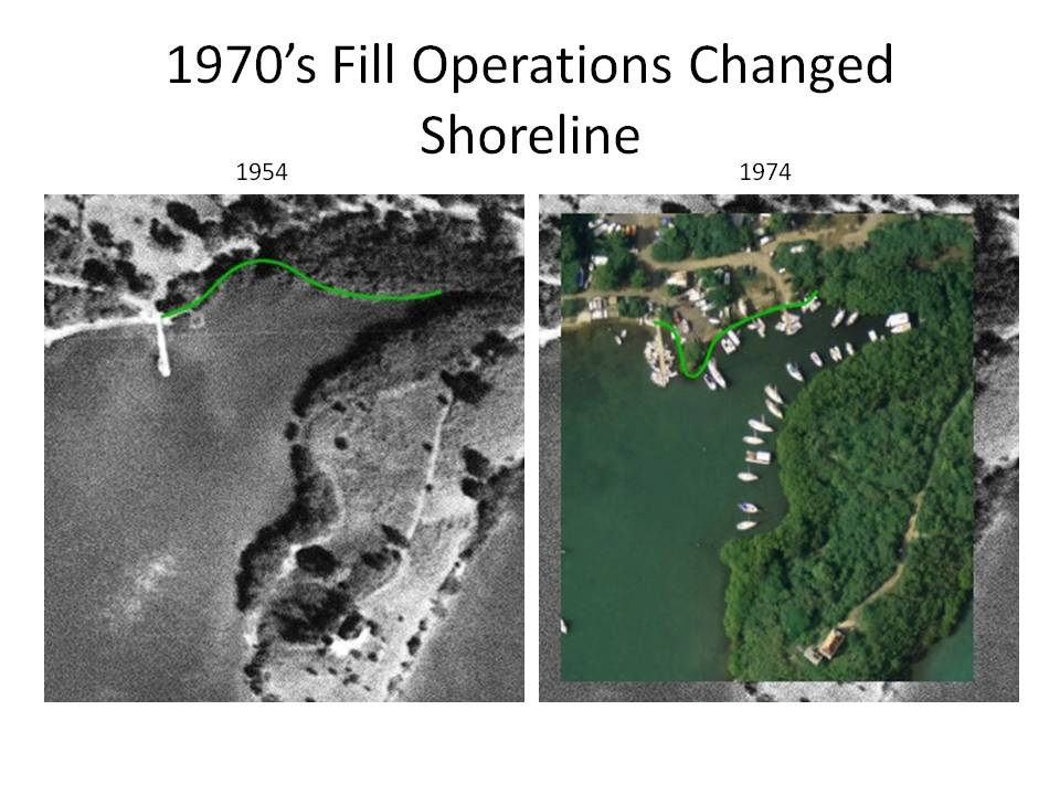
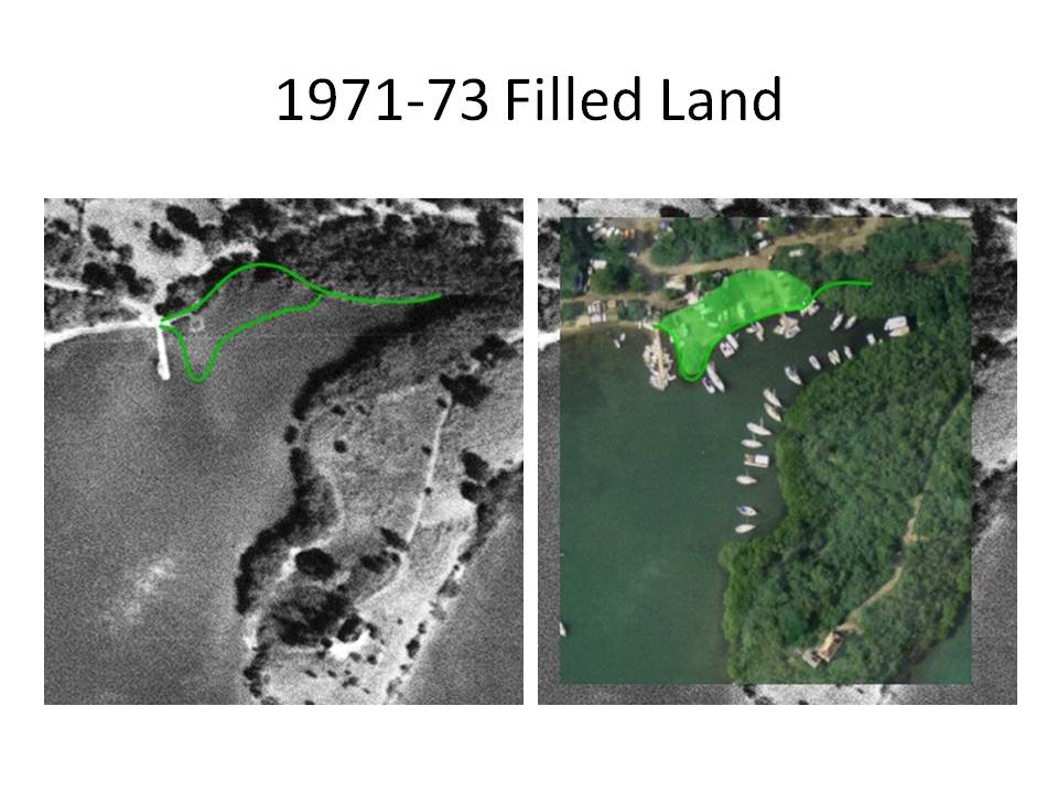
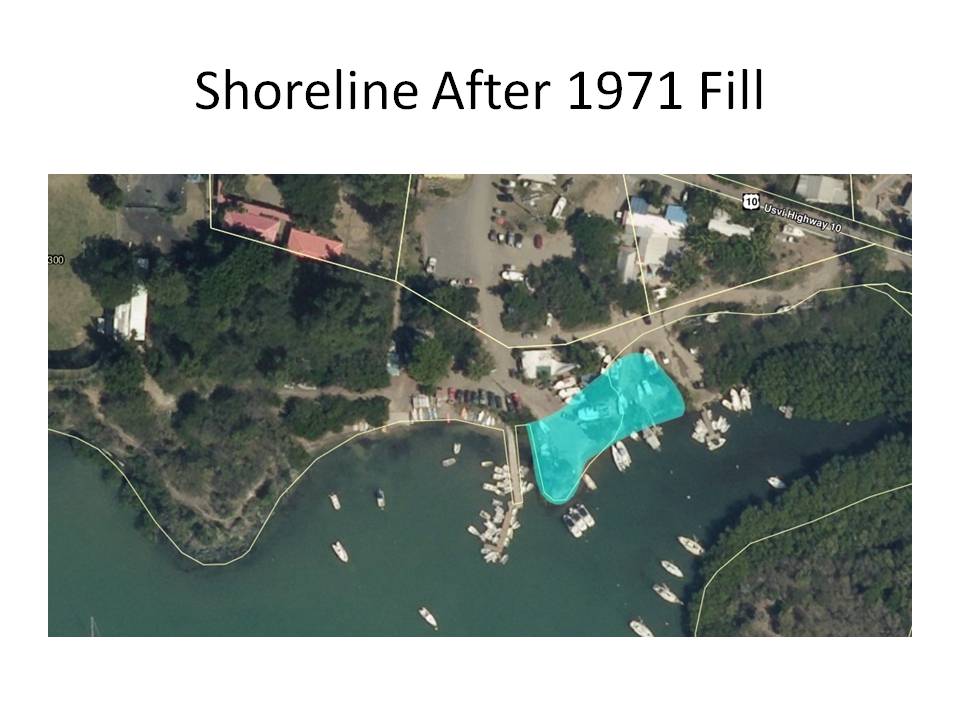
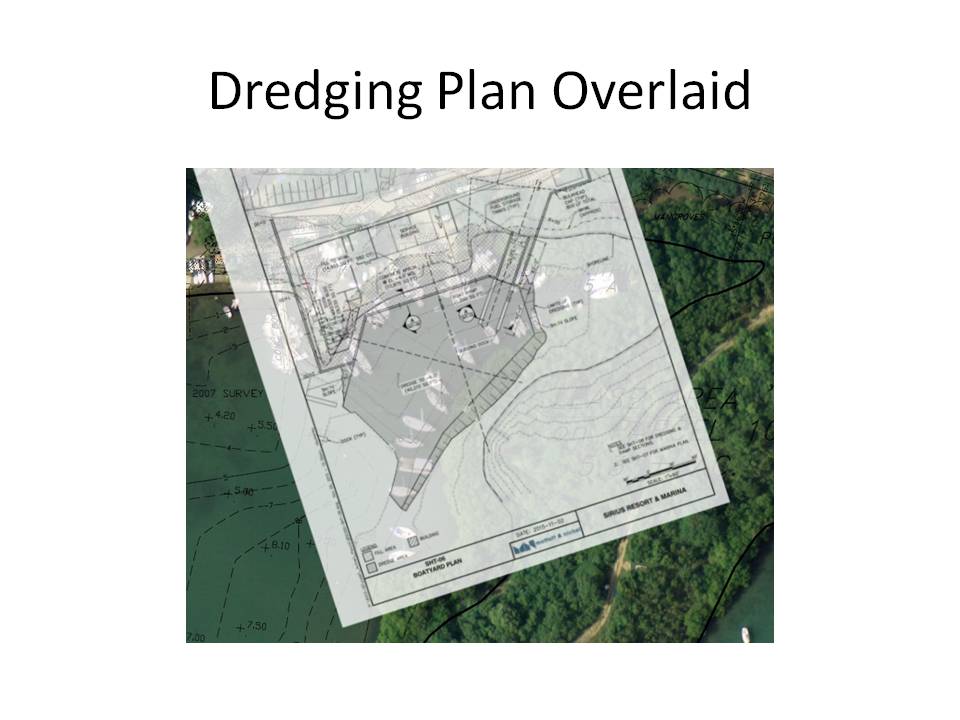
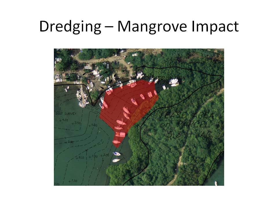
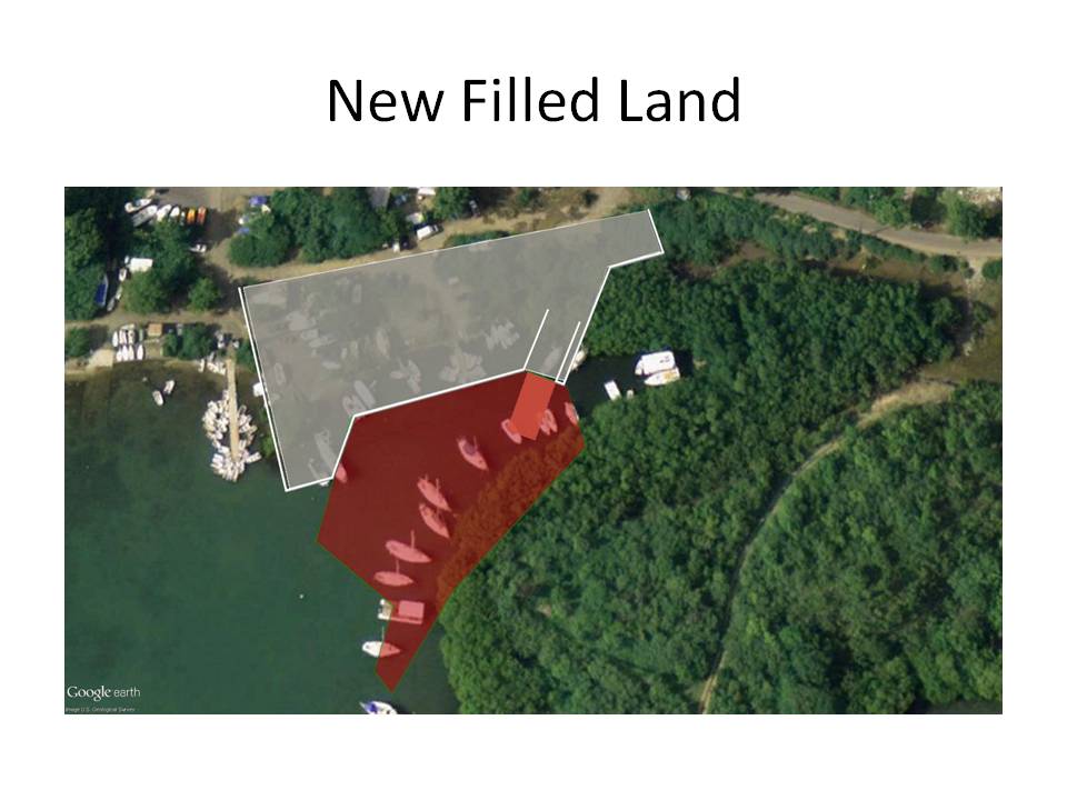
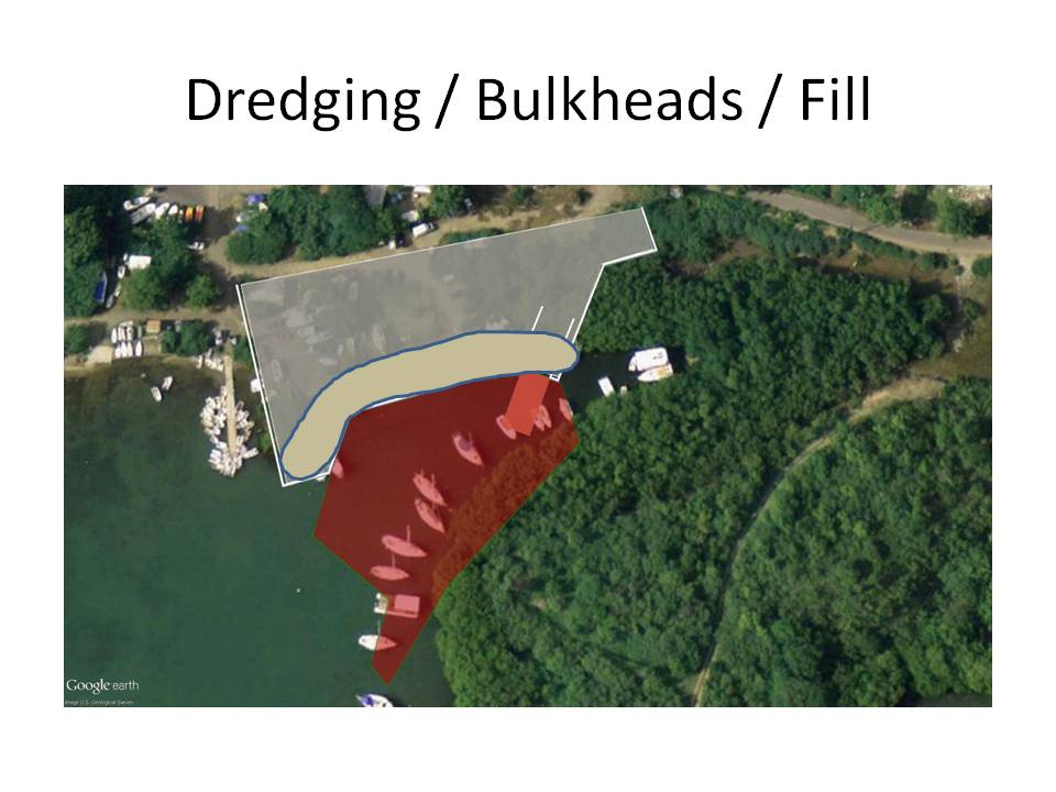
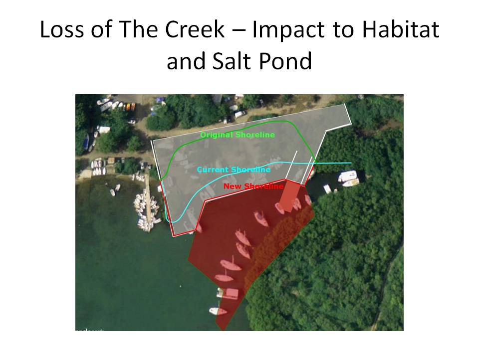
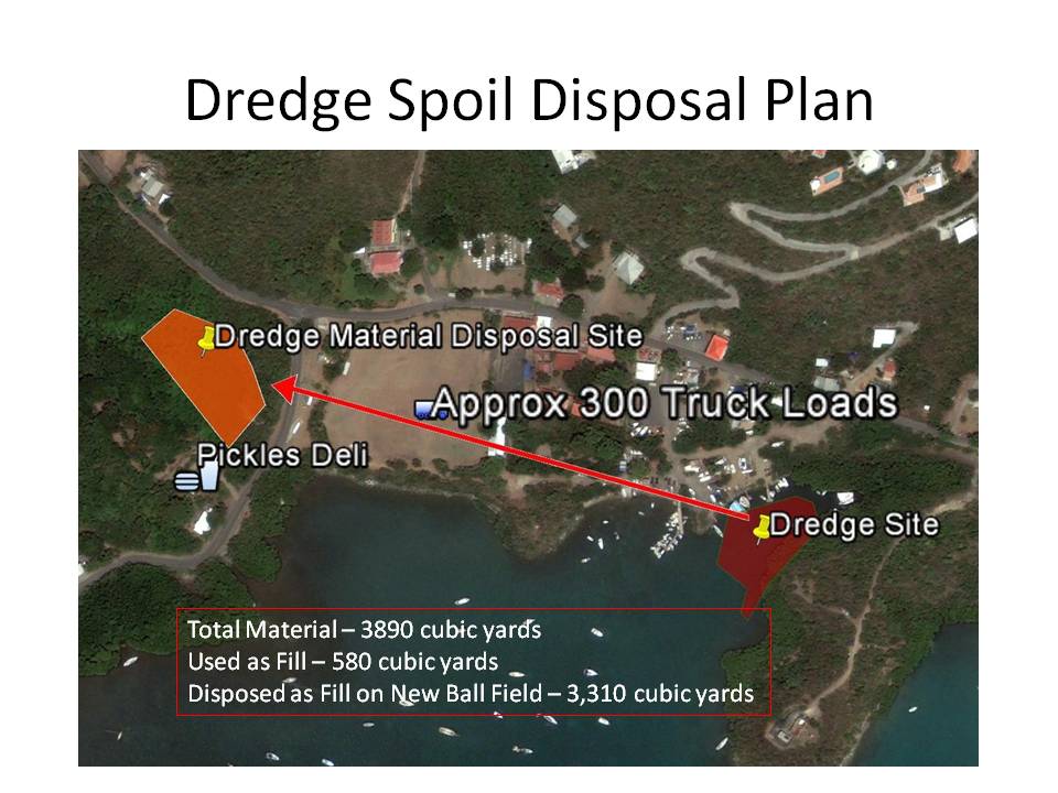
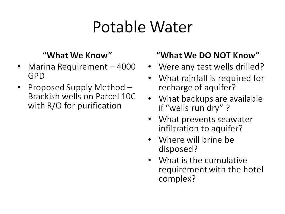
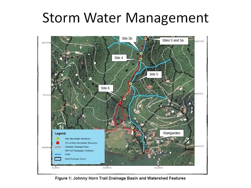
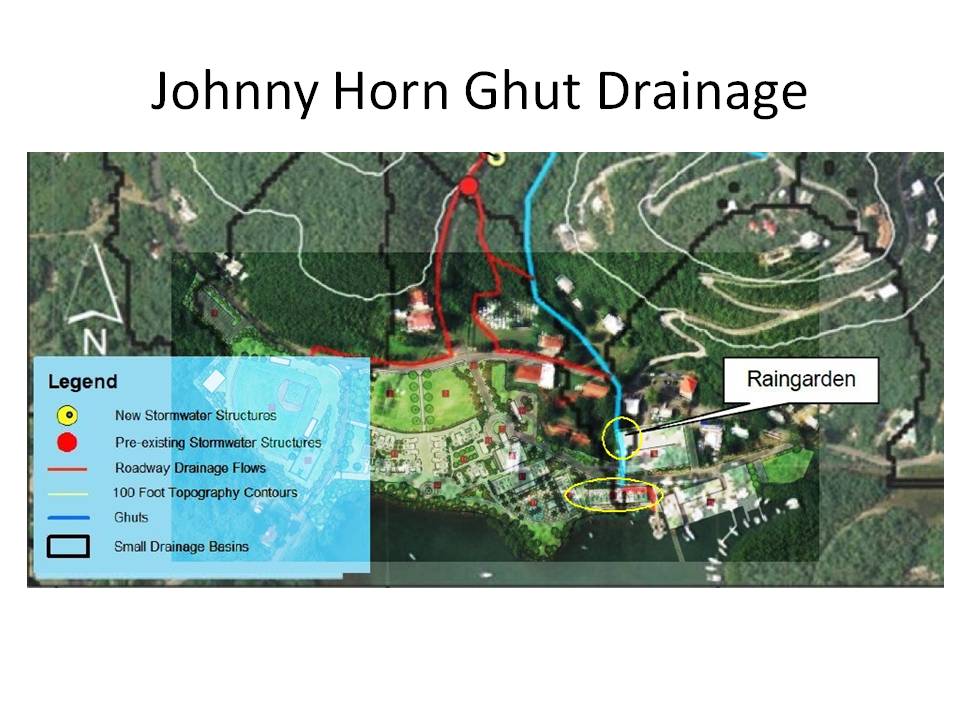
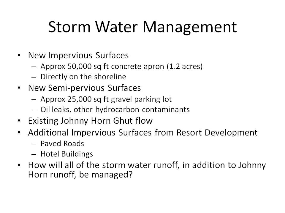
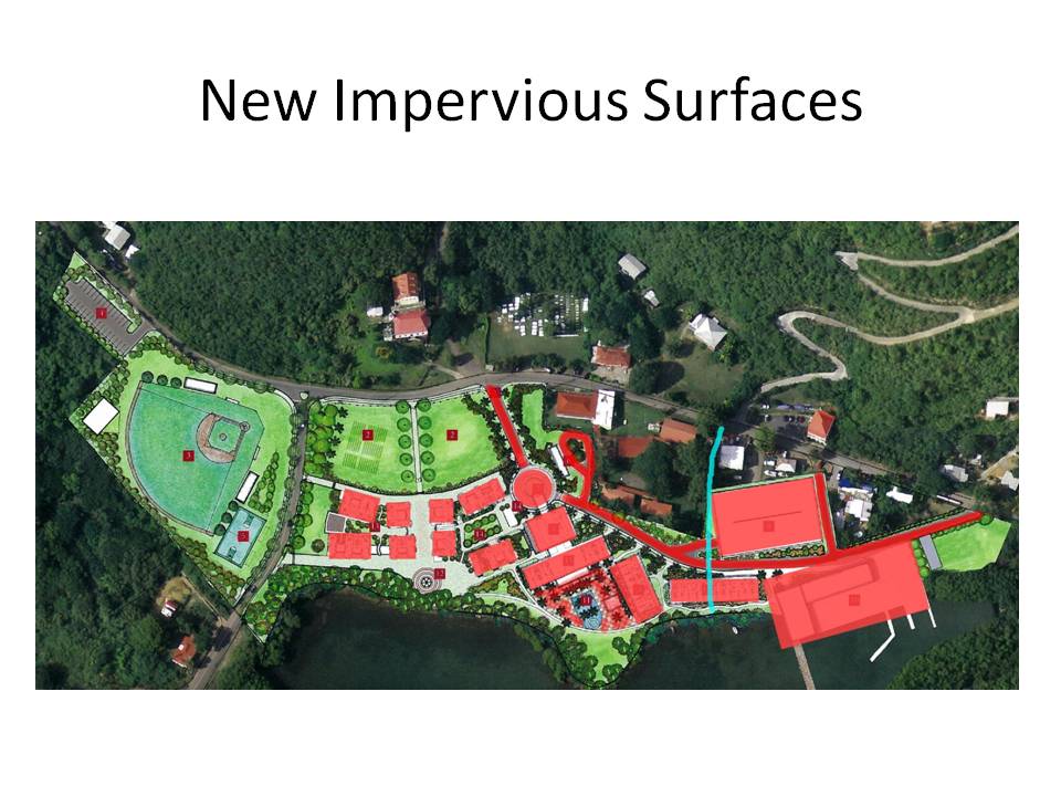
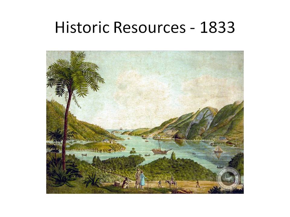
This presentation was part of a CBCC Community Forum regarding the proposed Sirius Resort and Marina. It represents the views of Save Coral Bay on a number of critical issues and concerns stemming from the proposed development.
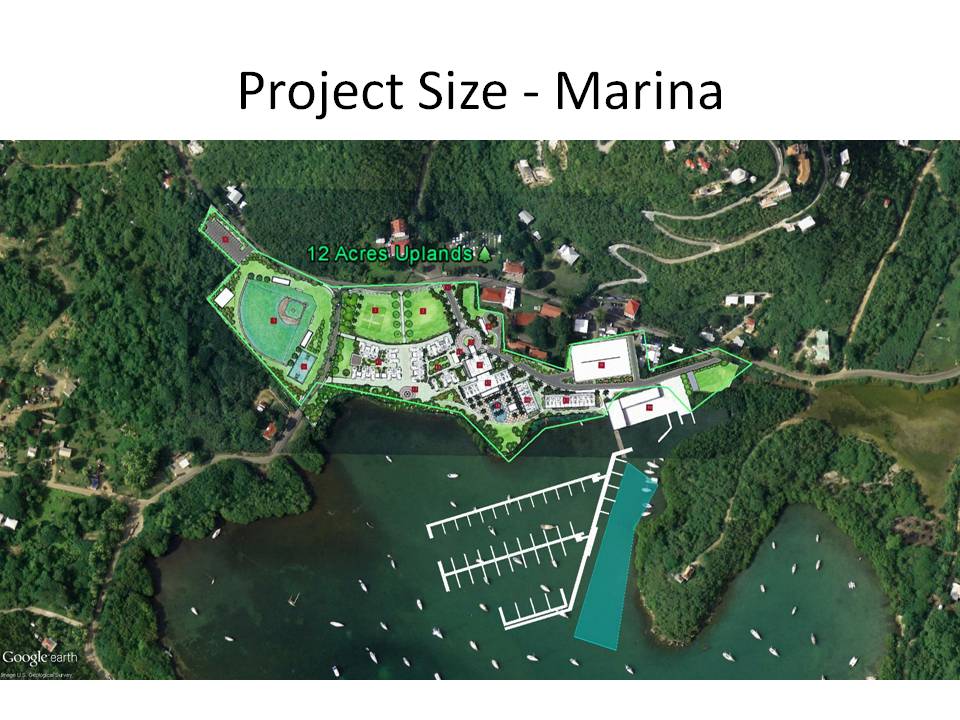
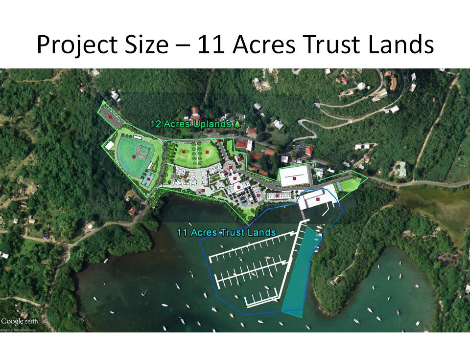
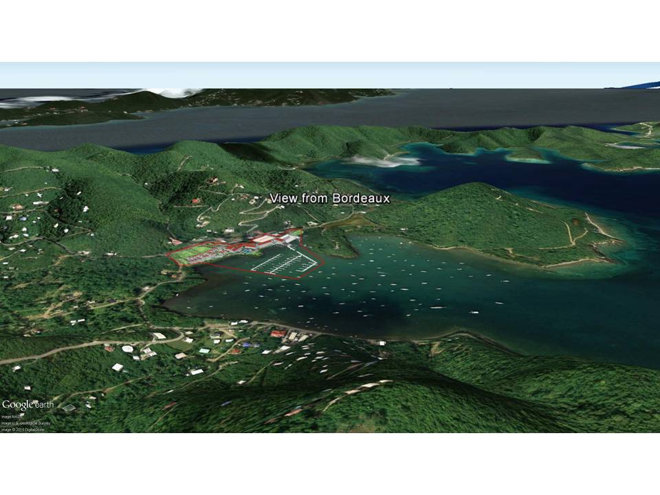
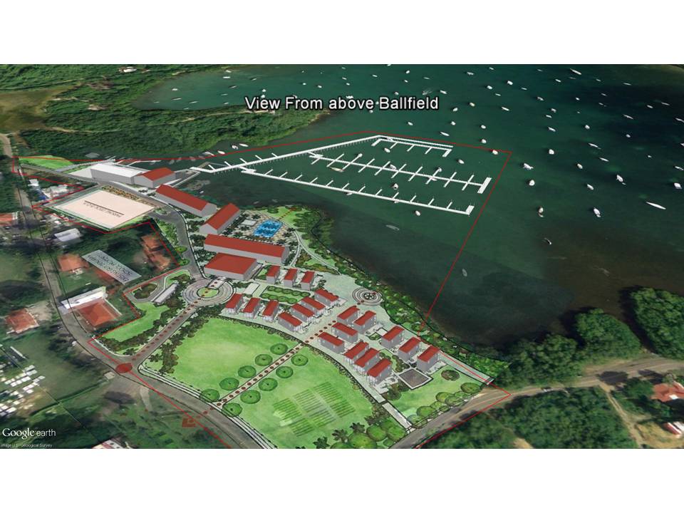
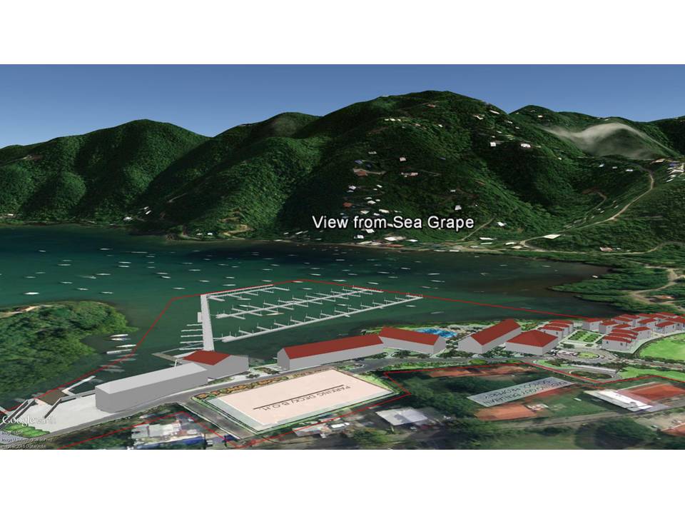
- This presentation was given at the CBCC Community Forum on January 11, 2016, dealing with the Sirius Resort and Marina application for an Army Corps permit. The forum included a presentation by the developer - Sirius (T-Rex) - and a presentation by Sharon Coldren of the CBCC. This presentation represents the views of Save Coral Bay on selected critical topics.
- On Friday, January 8, many people in Coral Bay were delighted to see that Coral Bay, St John, had been named by the New York Times among the top 52 places in the world to visit in 2015.
- Coral Bay ranked number 4 in the list. The article carried the admonition to visit Coral Bay before its laid-back atmosphere was destroyed by large scale development.
- This presentation is aimed at answering the question - "how large is the Sirius project" - and is it the type of project that might do just what the New York Times was warning. The application leaves many questions unanswered. Are there are alternatives to this proposal that would be more in line with the needs of the community.
- Here is an aerial view of the overall project site.
- These are the places that we all know - the Emmaus Moravian Church, the Coral Bay Ball Field, Skinny Legs, Pickles, the Guy Benjamin School, the historic Town Dock. This is Coral Bay as it exists today.
- And this is the same location in Coral Bay, overlaid with the "Sirius Conceptual Design" drawn up by the architect and developers. The project literally transforms most of central Coral Bay.
- In order to understand the scale of the development, and whether it is large by St John standards, let's look at the project components.
- These are the principle upland components - the new ball field, the hotel and resort complex, new parking areas, new marina buildings.
- The total area of the upland components occupied by the project is 12 acres.
- The marine components will occupy submerged land - Trust Lands of the Virgin Islands. The principle marine components are the marina docks, the new navigation channel, bulkheads, fill, and a new boat launch.
- These components encompass approximately 11 acres of submerged Trust Lands, making a total of 23 acres for the entire project,
- How large is 23 acres in St John development terms? The main parcel of the Westin Resort on Great Cruz Bay is 34.5 acres. The Sirius Resort and Marina, at 23 acres, is two-thirds the size of the Westin. This is a large project.
- Given its size, it will impact the view from virtually any vantage point of Coral Bay Harbor.
- Here is the view from upper Bordeaux. The resort and marina clearly occupy the northern shore and northeast corner of Coral Bay.
- Here is the view from above the ball field, coming down Centerline Road. The resort is the dominant feature extending the full length of the waterfront.
- From Sea Grape, the marina buildings, the 3-story boat building, the 1 acre parking lot, and the large marina complex will dominate the view.
- The main marina pier is directly offshore from Usher Cay and the navigation channel to the fuel dock is less than 200' from the mangroves.
- The view from the water approaching the north end of Coral Bay would be dominated by the marina slips, the shoreline marina structures, and the hotel complex.
- Water depths in this part of Coral Bay are marginal for a marina. The red area is less than 5', yellow is 5'-7' and green is 7'-10'.
- The applicants have proposed constructing a new boat ramp at the far end of the creek - the shallowest part - rather than use the existing boat ramp. As a consequence of this decision, and their desire to create new land, they are proposing dredging, bulkheading, and filling approximately 1/3 of the creek.
- Before any fill operations had been done in the creek, the mouth of the creek was considerably wider than it is today, and the shoreline had a small cove on the northern shore, circled in blue.
- There is a history of illegal fill operations in the creek. During the reconstruction of Centerline Road, considerable fill material was placed behind Skinny Legs, narrowing the creek (early 1970's).
- The extent of filled land can be seen by overlaying the 1954 image and the 1973 image.
- The shaded turquoise area is all filled land.
- This is the dredging plan proposed by Sirius. The shaded area would be dredged to a depth of -6 feet.
- The dredge area is shown in red, and it is clear that it overlaps the dense mangroves on Usher Cay.
- The developers propose installing a steel bulkhead around 20-30' into the creek, and backfilling with the dredged materials, in order to create new fastland.
- This image shows the dredge area in red shading, the new filled land in brown, and the bulkheads and concrete apron in grey.
- As a result of multiple fill operations the creek has been significantly degraded, and the bulkhead would cut off the water supply to the adjacent wetland salt pond.
- Since there is insufficient capacity behind the new bulkhead to accommodate all of the dredge spoils, the applicant has proposed moving over 3,000 cubic yards of dredge material - around 300 truck loads - onto the parcel at the southwest corner of the triangle intersection. This location is a known flood plain (the main Carolina ghut traverses the parcel), as well as a potentially significant archaeological site.
- The applicant proposes to obtain potable water through onsite wells. There is no scientific evidence that this will be possible without damaging the aquifer due to salt water intrusion. There is no discussion of how the effluent from the reverse osmosis of the brackish well water will be safely disposed.
- Surface water runoff from higher up in the watershed is a major concern. This has not been addressed by the applicants.
- The Johnny Horn ghut traverses the property, and in fact goes directly beneath one of the proposed hotel buildings. There is no discussion of how this ghut flow will be diverted or managed.
- In addition to the existing storm water entering the site, the applicants propose approximately 50,000 square feet of new impervious surfaces, and 25,000 square feet of semipervious surfaces.
- The areas shaded in red are either new impervious (paved or rooftop) surfaces, or semi-pervious surfaces (gravel parking lot). Paving this much surface area directly on the shoreline is a major concern.
- The entire area has a rich historical legacy, which would be entirely transformed and lost through the development of this marina and resort complex.
- The historic town dock is shown here in an 1896 photograph with the school children of Coral Bay waiting for the arrival of Prince Karl of Denmark. The house on Usher Cay is in the background. The applicant proposes demolishing the historic town dock.
- The ball field itself has been in continuous use as a sports and recreation facility since at least the 1940's. It would be taken over by 25 rooms of the hotel complex.
- The location of the proposed new ball field is unsuitable for this use. The location is a floodplain with the main Carolina ghut traversing the parcel. The soil type is characterized as "unsuitable for playgrounds".
- There has been no demonstration that the project is either economically feasible, will produce economic benefits for St John, and will not destroy the very things which make Coral Bay a destination of choice for hundreds of thousands of visitors.