We have reviewed the documents provided by the Army Corps of Engineers in conjunction with the Public Notice for the Sirius Marina in Coral Bay and have compiled a list of unanswered questions. Many of these questions would be addressed in a comprehensive environmental assessment, however we have not been given such a document to review. We encourage people to ask questions and make comments about potential impacts to the natural environment, the human environment and the economic environment in their letters to the Corps.
GENERAL CONCERNS
- Permit Application Documents
- Only very rudimentary information was provided in the USACE application – no EAR, no Archeological study, no economic analysis. Although Sirius has provided some of this information to the Corps (we know this through FOIA), the Corps has not published it for public comment.
- The drawings are incomplete and inconsistent: in some places a precast floating concrete dock is depicted, in others a fixed dock is shown. The location of pilings is not shown. Building elevations are not shown.
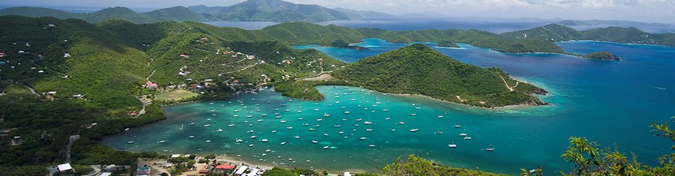
- The drawings do not align with each other or with other aerial maps of the region. The project location drawing does not encompass the actual project.
- Upland project components
- The application does not include any mention of the planned hotel and retail complex. Even though this may be outside USACE jurisdictional boundaries, the impacts on the marina design, water quality, runoff and potable water/waste water management are highly significant.
- The upland components which are depicted (gravel parking area, marina management, boat garage, bulkheads and concrete apron) are not accompanied by any detail required to analyze their impacts.
- No rain runoff computations for impervious and semi pervious areas.
- No description of rain water catchment – cisterns, etc.
- No information on the Waste Water Treatment Plant.
- Project boundaries
- A significant portion (approx 0.5 acre) of the “upland” land area is actually filled wetlands, filled illegally during 1973-74. There are many contemporaneous news articles and aerial photographs depicting the original shoreline and describing the legal action against the fill operation. This land is not owned by any private entity (including the Moravian Church) – it is Trust Land of the USVI.
- The project area impacts significantly on the littoral rights of adjacent land owners, specifically the owners of Usher Cay and Pickles restaurant.
- The boundary lines depicted in the drawings for natural features (shoreline, extent of mangroves) do not match aerial photographs.
INFRASTRUCTURE CONCERNS
- Potable (Fresh) Water
- The project notice only provides a single sentence dealing with water requirements (“A wastewater treatment plant, brackish wells with an R/O plant, a cistern, underwater fuel tanks and an emergency generator would also be constructed.”).
- The EA received through FOIA contains a 2-page “Preliminary Hydrogeologic Summary” that does not appear to have been conducted with any field testing. The preliminary report only concludes that there is a potential for wells to provide adequate supplies of brackish water for reverse osmosis purification. There are caveats having to do with location, recharge capacity, infiltration of sea water and geological formations.
- This is insufficient information to conclude that a well field would provide sufficient water for the marina, much less for the hotel and retail complex.
- There is no description of the proposed R/O system. There is no description of the method or location of disposal of the R/O brine. There is no structure shown for water storage.
- A combined calculation of potable water needs and supply methods (based on actual field data) for the marina and hotel complex must be provided for review and comment.
- Waste Water Treatment
- The drawings depict a WWTP located 50′ from Mean High Water and at an elevation of 4′ above sea level. There is no description of how effluent will be pumped uphill or how the plant will function during power outages.
- There is no quantitative data provided on the capacity requirements for the WWTP (no data in the PN), and no data on the W/W requirements of the hotel complex. Is a separate WWTP planned for the hotel? A combined calculation must be provided.
- The EA describes a need for 0.63 acres (27,500 sf) of landscape to consume 1″ per week of waste water effluent (marina only). However the drawings do not show any landscaped area in the marina site (concrete apron and gravel parking lot).
- Marina Fuel Supply
- The drawings depict two “Underground Fuel Storage Tanks”. These tanks are located seaward of the current shoreline. No information has been provided in the PN to describe how this will be safely engineered to prevent catastrophic water pollution if a tank should fail.
- The marina fuel is apparently dispensed from a floating fuel dock. How will the fuel line connection to the floating fuel dock be secured to ensure it will not fail during high wind/wave/tide turbulent conditions?
- Will fuel be delivered by barge? Where is the fuel barge dock ?
- The fuel dock is located in an area of extremely low water circulation, exacerbated by the dock structures and wave attenuators. It is also adjacent to healthy mangroves. Why was this location selected?
MARINA DESIGN AND CONSTRUCTION
- Marina Dock Design
- Although the drawings are not all consistent, it appears as though the majority of the marina is constructed from precast concrete floating sections. The size, design, and method of securing these sections (pilings) is not clearly shown.
- There is no data provided to indicate how floating concrete docks will perform under the wind, wave and tide conditions of Coral Bay Harbor.
- There are no drawings illustration the location of the 420 pilings described in the Public Notice.
- There are no geological studies done of the seabed to verify the depth of sediments, or depth to bedrock. This is critical to evaluate the feasibility of both the piling installation as well as the planned dredging. Local knowledge indicates that depth to hard bedrock is very shallow in the vicinity of the dredge site.
- The floating dock sections are opaque to sunlight (as opposed to elevated gratings). This is contrary to dock guidelines for construction over sea grass.
- The double-wide slips (accommodating two vessels each), in conjunction with floating finger piers, may not be safe for boats or boaters.
- Site specific wind and wave data should be provided.
- Marina Construction – Dredging
- The PN and drawings describe and depict a dredge area of approximately one acre (40,210 sf). Approximately 3,890 cubic yards of material are proposed to be removed to create a basin at a depth of -6 feet. This volume is equivalent to approximately 400 truck loads of sediments. The proposed primary disposal site is on the south west corner of the “triangle”, adjacent to the Pickles restaurant.
- The limits of the benthic survey do not apparently extend into the dredge area. On the benthic survey maps this area is not coded with any indication of the bottom conditions.
- The dredge area appears to be extremely close to the mangroves on Usher Cay and will most likely disrupt their root systems.
- There has been no data supplied to evidence the feasibility of dredging to -6 feet. Anecdotally it has been said that bedrock is very close to the seabed in parts of this area.
- The proposed disposal site appears to be a wetland, based on the soil type (Solitude A, frequently flooded), the elevation (2-4′ above sea level), and the presence of a ghut in this parcel. This disposal would therefore constitute filling of wetlands.
- The proposed disposal site would create unhealthful and unsanitary conditions for the adjacent property owner and business establishment (a restaurant and art complex).
- The effect of leaching of salts from the dredge spoil has not been discussed.
- Bulkheads and Concrete Apron
- The Public Notice and drawings describe construction of approximately 800 linear feet of bulkheads at an elevation of 4′ above sea level, and seaward of the current shoreline in some areas.
- The bulkheads would be backfilled with some dredge material to create new fast land. The entire surface landward of the bulkheads would be paved with a concrete apron.
- The environmental impacts of the bulkheads and paving have not been discussed. Storm water runoff from the concrete apron (approximately 1 acre, inclusive of buildings) has not been quantified or addressed. No catchment or cisterns are depicted.
- The potential for the bulkhead and dredging to impact sea water exchange with the adjacent salt pond has not been addressed.
ENVIRONMENTAL CONCERNS
- Natural Environment
- The impacts on documented shark habitat have not been discussed.
- The impacts on commercially valuable species (whelk, lobster, conch, etc.) have not been discussed.
- The sonic impacts on marine reptiles (turtles) and marine mammals (whales and dolphin) has not been discussed.
- The dredge area is directly adjacent to a known and frequently studied bird habitat (site of frequent Audubon bird studies). The impact on avian habitat has not been discussed.
- The extent of mangrove removal appears to be greater than what is stated in the PN.
- Economic Questions
- The PN does not supply sufficient information to evaluate the economic viability of the project. Will the marina be economically viable on a standalone basis, or does it depend upon the proposed hotel and resort complex for economic viability?
- How will the construction and operation of the marina impact existing businesses and ecotourism in Coral Bay? This has not been addressed.
- What is the justification and rationale for a 92-slip marina and 30-40 slip “dry stack” boat garage? Would a smaller facility meet the needs of the public better?
- Historic Resources
- The dinghy dock is an historically significant structure, in continuous use since the 19th century. The project will demolish and remove this structure. This should not be permitted.
- The adequacy of the archeological studies done in the water and on the land are dubious, given the rich history of the area and the apparent lack of findings.
- Other Concerns and Questions
- Earthquake hazard – the stability of the newly filled land behind the bulkheads has not been addressed. The dredged sediments may be fine grained materials which could liquefy in a moderate earthquake. Can a 3-storey boat garage be safely built within a few feet of this fill area?
- Tsunami hazard – the marina is in a tsunami hazard zone
- Social Impacts – the Kids and the Sea (KATS) program may be severely disrupted by this project.
- Social Impacts – the removal of the municipal dinghy dock during construction, without assurances that an alternative will be provided, will create severe hardship on existing boaters and charter operations.
- Emergency Services – what are the fire suppression procedures for a land-based fire in the “boat garage”? same question in the marina.
- Hazardous Materials – will boat maintenance operations be conducted on shore? Will this result in the creation of hazardous materials?
- Proximity to Restaurant – are there health or safety concerns given the proximity of a major Coral Bay eatery less than 200′ from the waste water treatment plant, fuel storage tanks, and boat garage?
- Relocation of Navigational Channel – the project proposes relocation of the existing navigational channel. Has this been reviewed by appropriate interested parties? If the dredging is not feasible will there be a viable navigation channel to shore ?
Cultural Heritage
- What is the impact of the proposed marina on property taxes in Coral Bay given the oppressive property tax assessments on St. John?
- Is the marina going to create a space that reinforces schemas of racial and ethnic difference?
- What’s the cultural impact? What systems of knowledge and ways of being human are lost to predatory capitalism when our coastal areas are continuously converted into playgrounds for predominantly wealthy, non-local, typically white people?