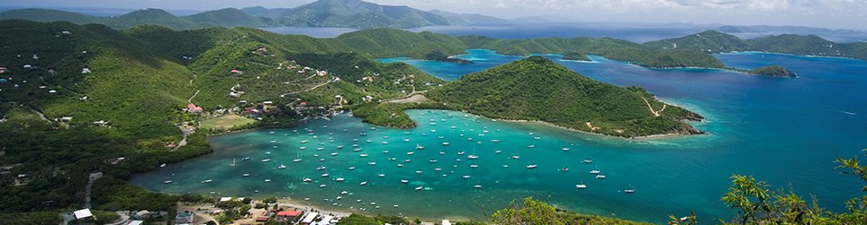
Flood Plain Considerations for Sirius Marina
Reproduced below is a portion of the FEMA flood hazard zone rate map which includes the vicinity of the proposed Sirius Marina:
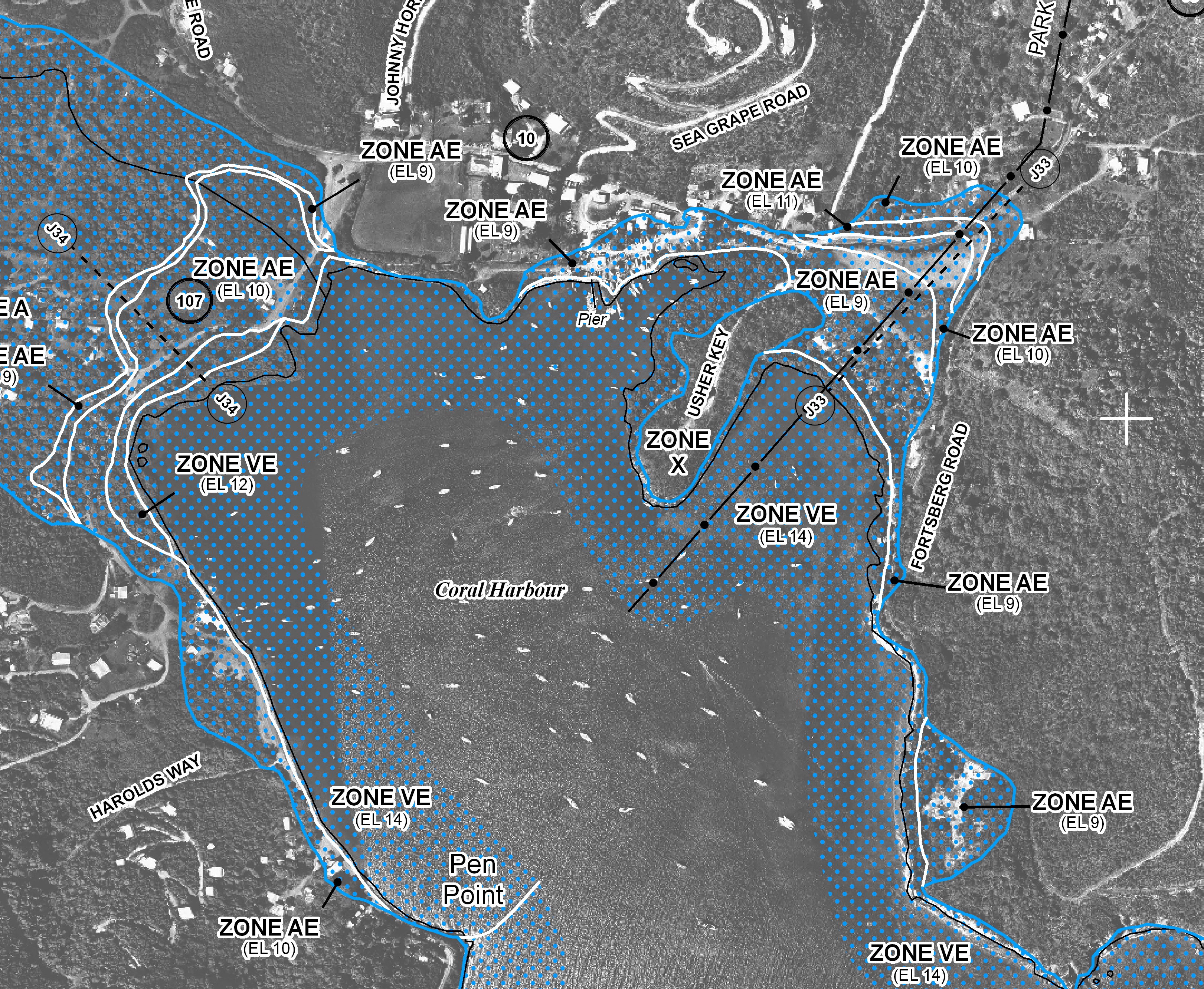
This map is captioned “Federal Emergency Management Agency, National Flood Insurance Program, Flood Insurance Rate Map, Panel 0035G, Map Number 780000035G, Map Revised April 16, 2007.”
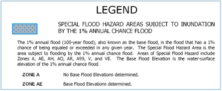
The Zones shown with blue dots are flood hazard zones, and the AE zone which is of interest to the Sirius Marina project is described in the map legend below:
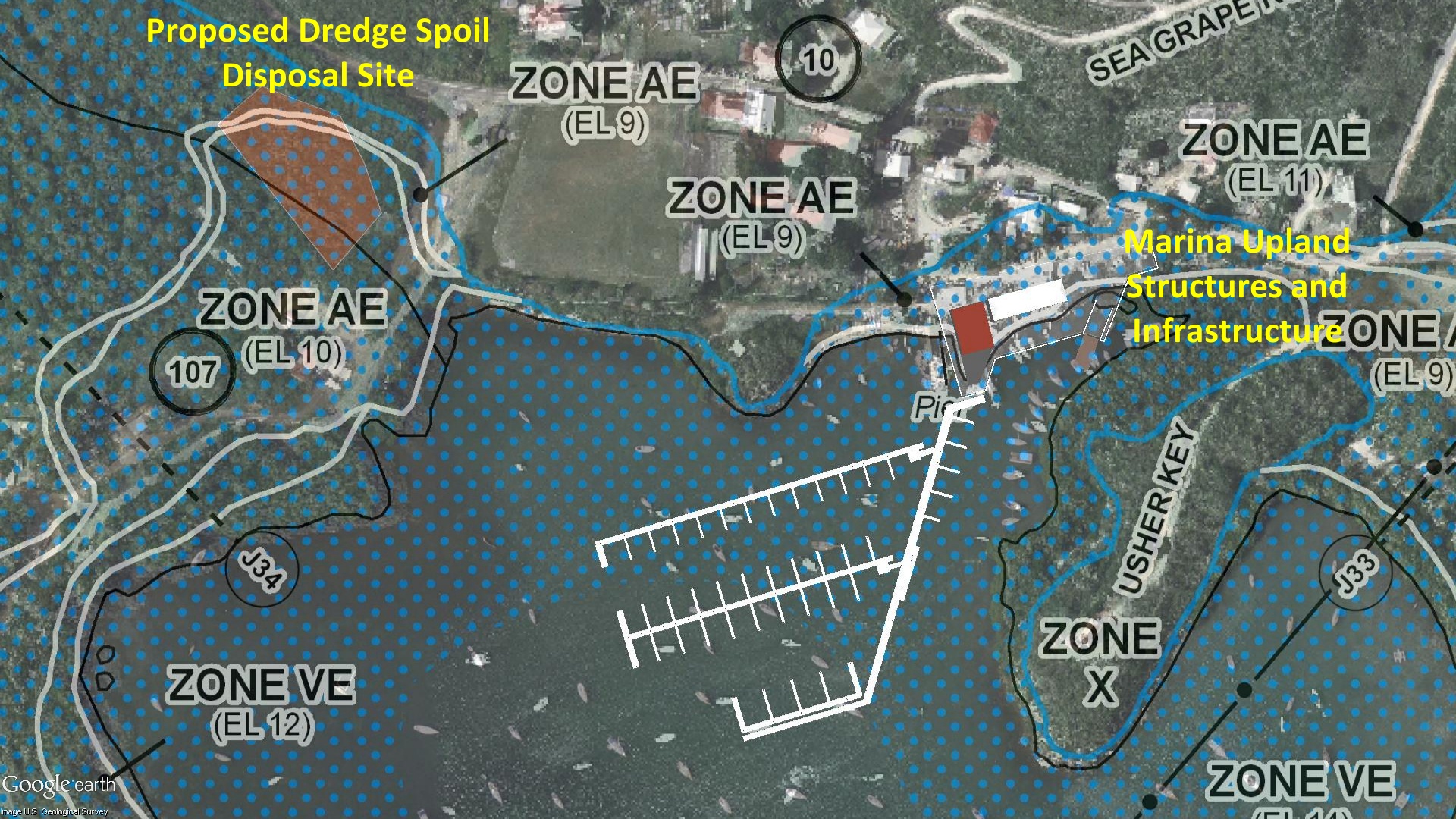
The illustration below overlays the main components of the Sirius Marina project on the FEMA flood hazard map. It is apparent that the marina upland structures (office, marina service building), the marina infrastructure (Waste Water Treatment Plant, Underground Fuel Tanks, Water Supply, Backup Generator) are all within the flood zone. It is also apparent that the proposed dredge spoil disposal site is within a flood zone and a drainage ghut traverses the site.
The requirements for consideration of flood plains is stated in 33 CFR 320.4 which reads, in part:
In accordance with the requirements of Executive Order 11988, district engineers, as part of their public interest review, should avoid to the extent practicable, long and short term significant adverse impacts associated with the occupancy and modification of floodplains, as well as the direct and indirect support of floodplain development whenever there is a practicable alternative. For those activities which in the public interest must occur in or impact upon floodplains, the district engineer shall ensure, to the maximum extent practicable, that the impacts of potential flooding on human health, safety, and welfare are minimized, the risks of flood losses are minimized, and, whenever practicable the natural and beneficial values served by floodplains are restored and preserved.
Elsewhere in these comments we have identified practicable alternatives that do not involve occupancy or modification of floodplains.
It is of particularly grave concern that depositing 3300 cubic yards of fine dredge spoils in a possible wetland, a known flood hazard zone, atop a mapped drainage ghut, and less than 200 feet from the shoreline of Coral Bay, is a disaster waiting to happen. A major rain event could wash tons of dredge material directly into Coral Bay harbor, smothering everything in its path. For this reason alone, the selected dredge disposal site must be denied.